Every construction and renovation project reaches a point where someone needs to work from a drawing. Whether that’s an architect detailing a renovation, a contractor coordinating trades, or a facility manager planning future work — the quality of that drawing determines how smoothly the project goes.
If you’ve worked with a 3D laser scanning firm, you’ve probably heard the term “point cloud.” It shows up in proposals, deliverable lists, and project conversations. But it doesn’t always come with a clear explanation. This post breaks it down so you know exactly what you’re getting and how to use it.

Start with the basics
A point cloud is a collection of millions of individual data points. Each point represents a precise location in three-dimensional space. Together, those points form a dense, accurate digital record of a physical environment — a building, a site, a mechanical system, or any space that’s been scanned.
Think of it this way. Imagine you could freeze a building in place. Then mark the exact location of every surface — every wall, ceiling, column, pipe, beam, and floor — with a tiny dot in 3D space. The result would be a point cloud. Each dot carries an X, Y, and Z coordinate. Taken together, millions of those dots define the shape and geometry of the space. Moreover, they do it with a level of accuracy that tape measures and manual field notes simply can’t match.

How point clouds are captured
Point clouds come from 3D laser scanners. At TWG, we use the Leica RTC360. It works by emitting laser pulses in every direction. Each pulse bounces off a surface and returns to the scanner. The scanner then measures the return time and calculates the distance to that surface. From there, it records a data point.
The scanner repeats this process millions of times per second. It rotates to cover the full environment around it. In a single scan position, the RTC360 captures up to two million points per second. Across a complete project — which typically involves dozens of scan positions — the result is a dense, three-dimensional record of the space as it actually exists.
As a result, the data reflects reality rather than an approximation. Walls are where they actually are. Structural elements are documented as they stand. Mechanical systems appear in three dimensions. Nothing is estimated or assumed.

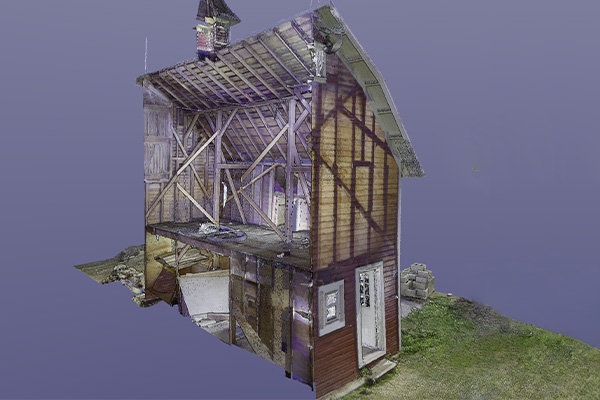
What a point cloud looks like
Raw point cloud data looks like a dense cloud of colored dots — hence the name. Each point takes on a color based on the surface it hit. Consequently, the visualization often resembles a photograph of the space, except rendered in millions of tiny dots rather than pixels.
In software like Autodesk ReCap or Cyclone REGISTER 360, point clouds are fully navigable. Designers and engineers can zoom, rotate, and take accurate measurements directly from the data. In addition, they can do all of this from their desk — without a return site visit.

How point clouds become usable deliverables
A point cloud is a starting point, not a finished deliverable. The next step is turning that raw scan data into something your team can work from.
At TWG, that typically means one of two things. First, we build a coordinated Revit model directly from the point cloud. This gives your team a fully navigable 3D BIM model that reflects verified existing conditions. Second, we produce 2D CAD drawings — floor plans, elevations, and sections — derived directly from the scan data.
Both deliverables trace back to the same source: the point cloud. As a result, the dimensions in your drawings and the geometry in your model reflect the building as it actually exists today. Not as it was documented years or decades ago.

Why point clouds matter for your project
The practical value of a point cloud is straightforward. Projects that start from inaccurate existing conditions run into field surprises. Walls aren’t where the drawings show them. Systems conflict with new work. Dimensions don’t hold up when construction begins.
A point cloud removes the most common source of those surprises. Instead of starting from old drawings or manual measurements, your team starts from verified, accurate data. Architects design from dimensions they can trust. Contractors coordinate from conditions they’ve seen documented. Trades avoid clashes that would otherwise surface mid-construction.
In short, a point cloud gives your project a foundation that reflects reality. And that’s where accurate, confident work begins.
Want to see what laser scanning can do for your project?
At The Wassi Group, our team uses the Leica RTC360 to capture accurate existing conditions for architects, contractors, and facility managers throughout Central Illinois and beyond. Whether your project calls for 3D laser scanning, CAD drafting, or construction printing, our goal is always the same — give your team accurate, reliable documentation you can build from.