
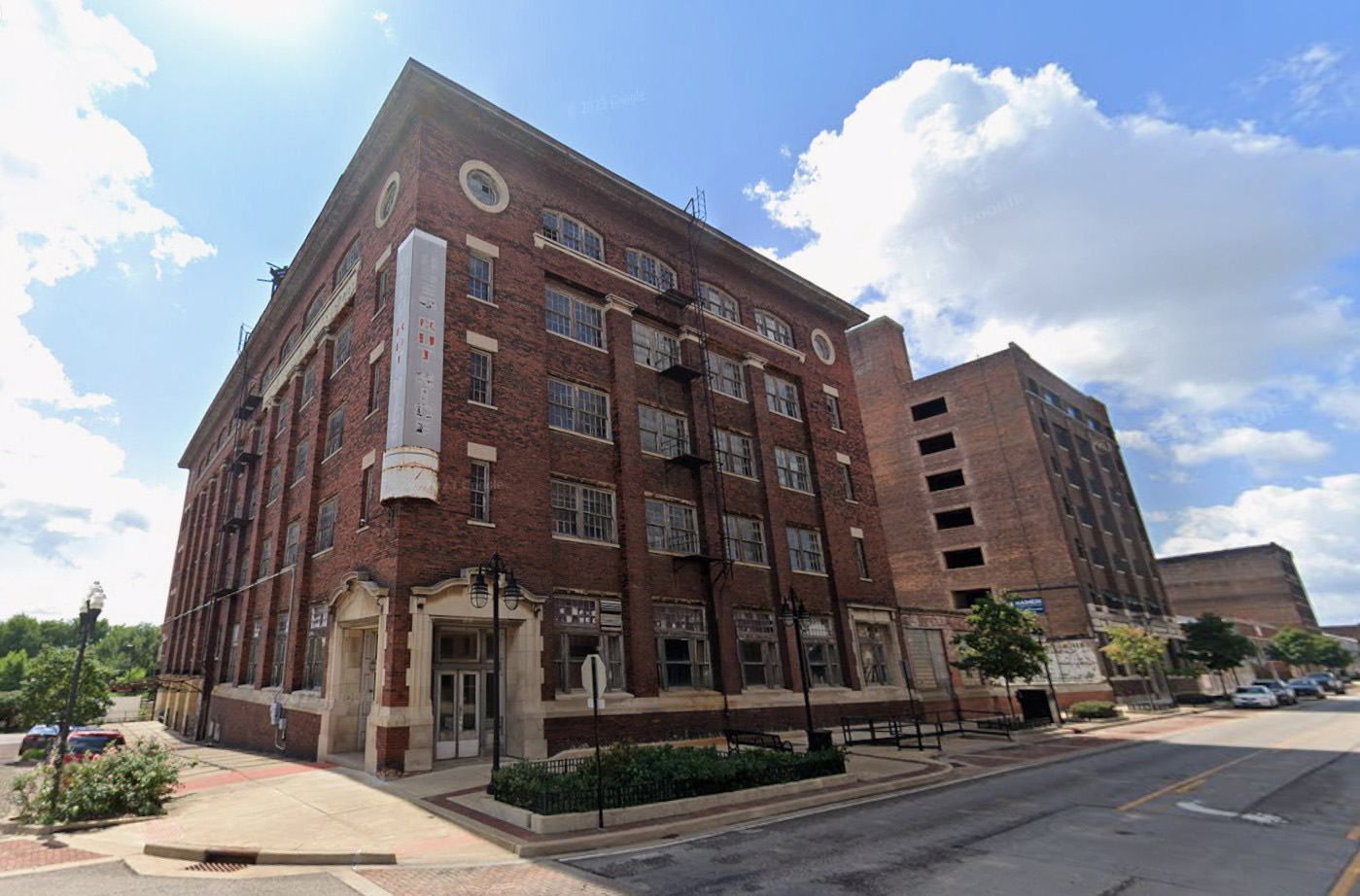
Oculus Development needed to convert a historic downtown Peoria warehouse into ADA-accessible apartments. First, they needed accurate existing conditions documentation of the entire structure — interior and exterior — before design and permitting could begin. TWG deployed the Leica RTC360 on-site to laser scan the building and delivered a coordinated Revit model that gave the project team a reliable foundation to work from.
Project Details
- Tools: Leica RTC360, Autodesk Revit
- Client: Oculus Development
- Project Type: Historic Building Laser Scanning, Adaptive Reuse Documentation
- Deliverables: Point Cloud Data, Coordinated Revit Model
The Challenge: Documenting a Historic Structure for Modern Use
Historic buildings present unique existing conditions documentation challenges. Original drawings are often incomplete, inaccurate, or missing entirely. In addition, decades of modifications leave structures that differ significantly from any available records.
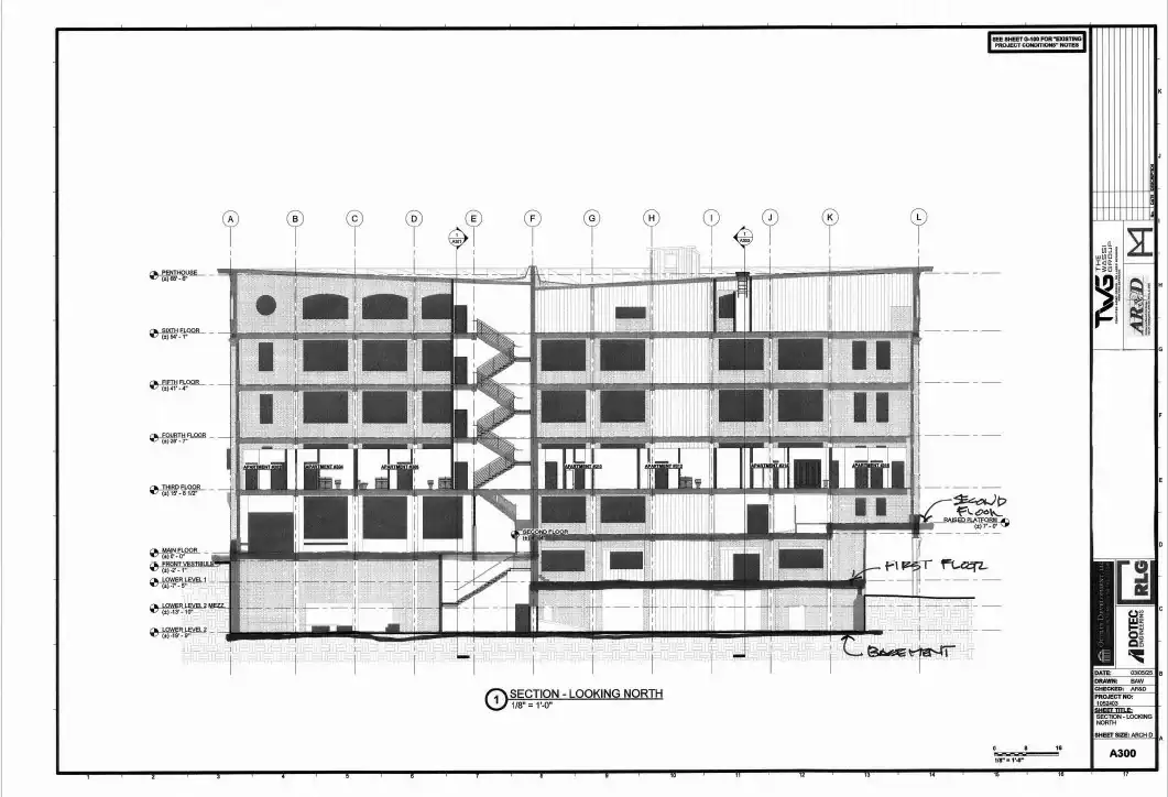
For Oculus Development, accurate existing conditions documentation was essential. The conversion required precise knowledge of the building’s interior layout, structural geometry, wall thicknesses, and overall dimensions. Furthermore, ADA compliance planning demanded accurate floor-to-floor heights, doorway dimensions, and circulation path documentation. Approximating any of those conditions wasn’t an option — errors at the documentation stage would follow the project into design and permitting, creating costly corrections down the line.
Our Solution: Laser Scanning for Accurate Existing Conditions
TWG began by deploying the Leica RTC360 throughout the warehouse. The scanner captured millions of precise measurements across the building’s interior and exterior in a single coordinated site visit. As a result, every surface — walls, floors, ceilings, structural elements, and openings — was documented accurately without relying on manual measurements or outdated records.
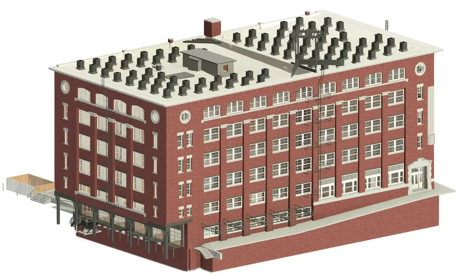
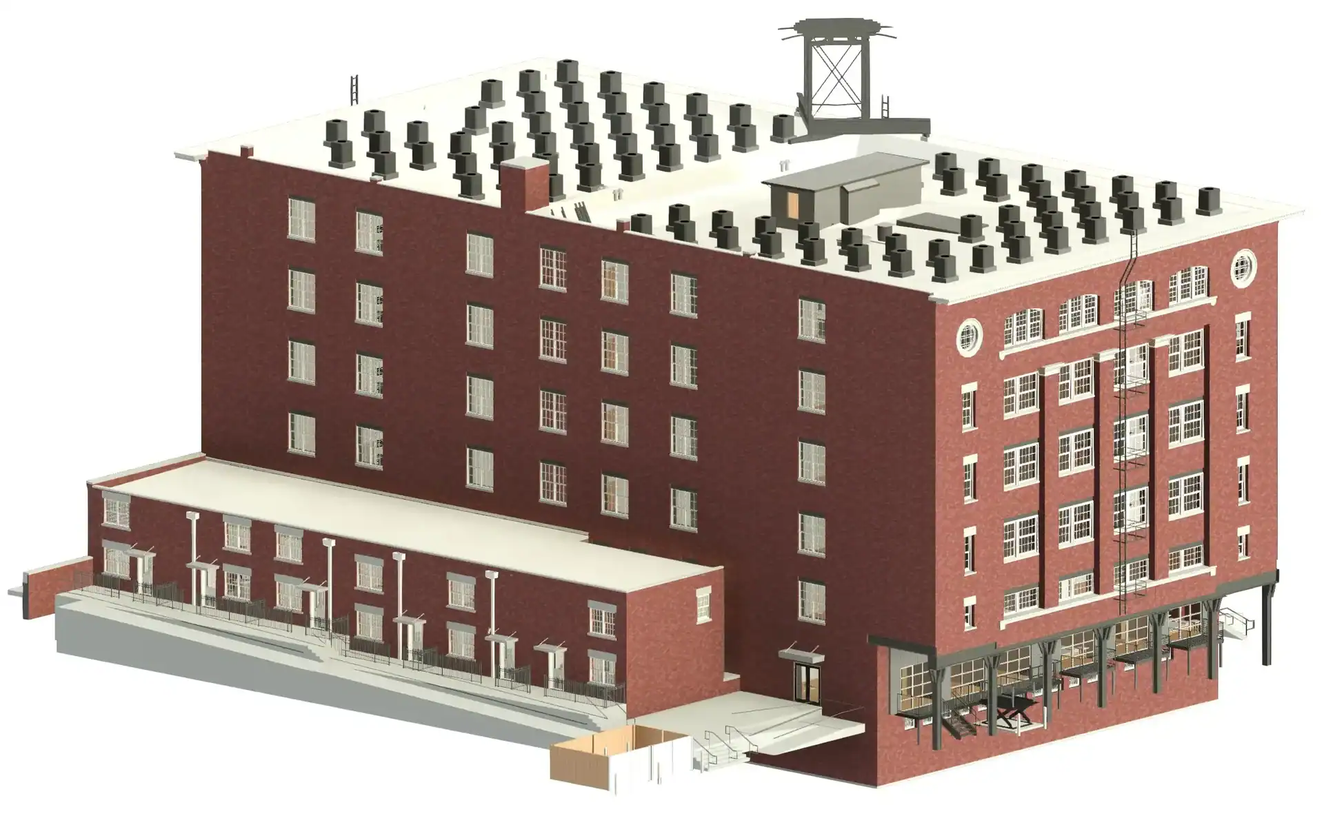
Next, TWG processed the point cloud data and built a coordinated 3D Revit model directly from that scan data. Consequently, the model reflected the building exactly as it exists today — not as it was originally built or approximated from incomplete drawings.
Not sure what point cloud data looks like or how it becomes a usable Revit model? Read our guide on what a point cloud is and how it works.
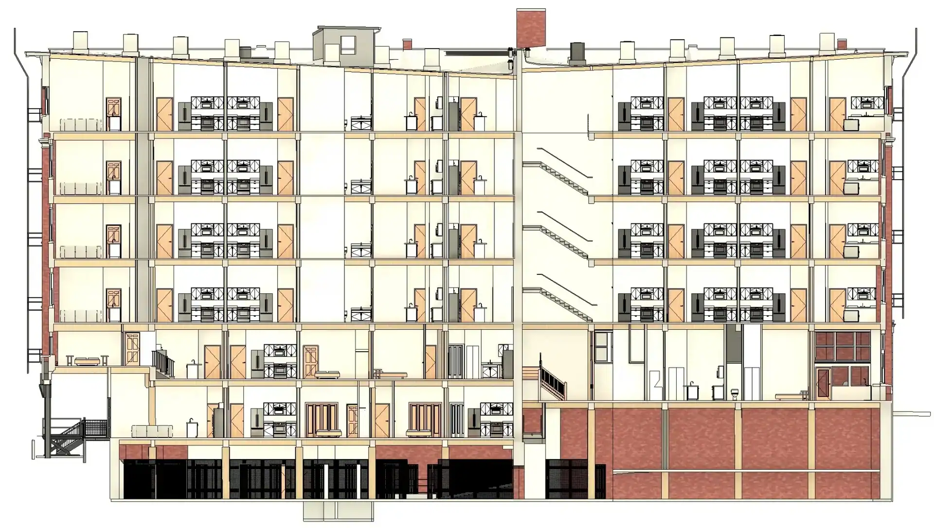
Deliverables: A Coordinated Revit Model for Design and Permitting
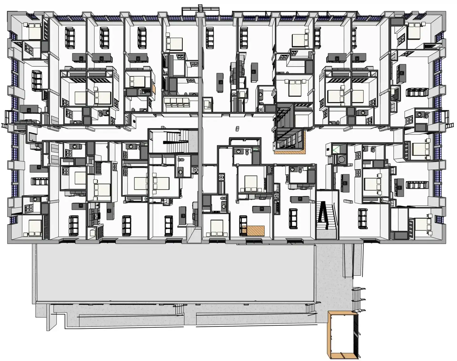
TWG delivered a complete coordinated Revit model of the historic warehouse — built directly from verified laser scan data. The model gave Oculus Development and their design team accurate existing conditions documentation they could use immediately for renovation planning, architectural design, and permit submissions.
The deliverable set included:
- High-density point cloud data captured with the Leica RTC360
- Coordinated 3D Revit model of the building’s interior and exterior
- Accurate documentation of structural geometry, openings, and circulation paths
The Result: Accurate Documentation for a Complex Adaptive Reuse Project
Oculus Development started the design process with verified existing conditions rather than approximated measurements. As a result, the project team could preserve historic features while confidently planning the modifications needed to meet modern ADA accessibility standards. In addition, the coordinated Revit model streamlined architectural and engineering workflows — reducing on-site measurement time and minimizing the risk of design revisions driven by undocumented field conditions.
This project demonstrates how laser scanning a historic building before adaptive reuse work begins removes the guesswork from one of construction’s most complex project types.
Notable Projects in Central Illinois
TWG regularly works with developers, architects, and contractors on historic building documentation and adaptive reuse projects throughout Illinois. Other notable local projects include laser scanning and Revit modeling for The Cathedral of St. Mary for the Catholic Diocese of Peoria, existing conditions documentation for the Peoria Civic Center Renovation, and Hub & Spoke and Perfect Promotion on Morton’s Main Street.
Ready to Document Your Historic Building?
TWG works with developers, architects, and project teams throughout Illinois and beyond. Whether your project calls for 3D laser scanning, CAD drafting and Revit modeling, or construction printing, our goal is always the same — give your team accurate, reliable documentation you can build from.
If your project is in the region, visit our dedicated page for 3D laser scanning in Central Illinois to learn more about how TWG supports local project teams.