Renovation, design, and construction projects depend on one thing above everything else — accurate information about what’s already there. For project teams throughout the Central Illinois area, The Wassi Group delivers professional 3D laser scanning that captures existing conditions with accuracy, giving architects, engineers, contractors, and facility managers a reliable foundation to plan from.
Why accurate laser scanning documentation matters
Existing buildings rarely match their original drawings. Over time, walls shift and structures settle. In addition, decades of renovation work leave gaps in documentation that cause real problems when new work begins. As a result, project teams often start from approximations rather than reliable information. That uncertainty at the planning stage leads directly to field errors, unexpected costs, and avoidable delays.
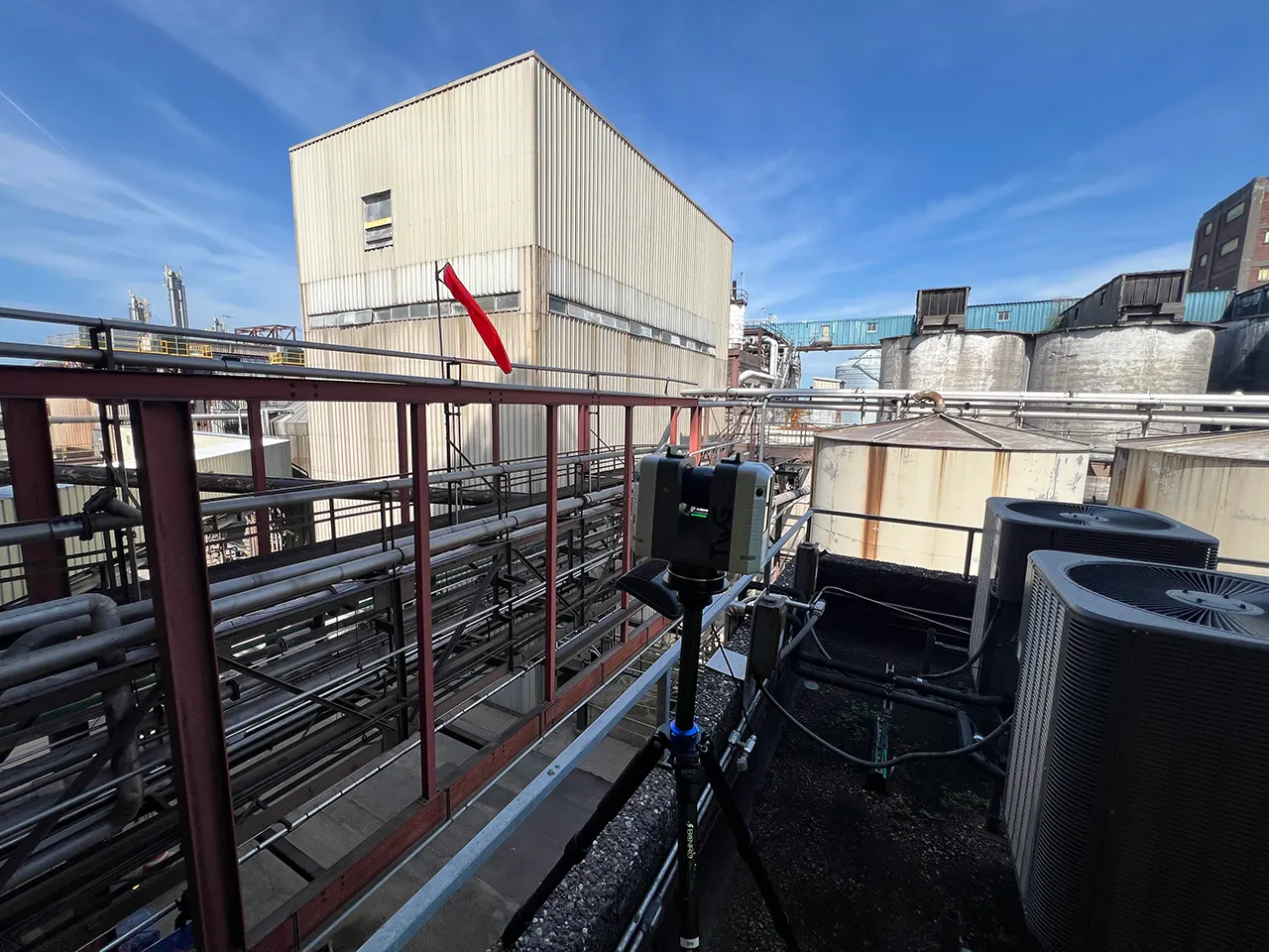
3D laser scanning closes that gap. Instead of relying on tape measures and manual field notes, TWG’s team deploys the Leica RTC360 directly on-site. The scanner captures millions of measurements quickly and completely, taking a fraction of the time traditional surveying requires. As a result, your team receives a detailed point cloud — and from there, a Revit model or CAD drawing you can actually build from.
What we deliver
- Point cloud data — high-density, accurate scan data captured with the Leica RTC360
- Revit models — coordinated BIM models built from scan data for design, renovation, and construction planning
- CAD drawings — 2D floor plans, elevations, and sections derived from verified existing conditions
- Existing conditions documentation — complete building documentation for facility management, historic preservation, or pre-construction planning
Who we work with in the Peoria region
- Architects and engineers planning renovations where as-built drawings are missing, outdated, or unreliable
- General contractors who need verified existing conditions before work begins to reduce field surprises and coordinate trades more accurately
- Facility managers at commercial buildings, industrial plants, and institutions who need reliable floor plans and building documentation for ongoing maintenance and planning
- Historic preservation teams documenting structures where accuracy and non-invasive capture methods are essential
- Industrial facilities in the Peoria area requiring accurate documentation of equipment, pipe routing, and structural steel for plant modifications and upgrades
Serving Peoria and the surrounding region
Based in Morton, IL, The Wassi Group has served construction and design professionals throughout Central Illinois for nearly 30 years. Our team regularly works across the Peoria metro area — including Peoria, Peoria Heights, East Peoria, Washington, Chillicothe, and surrounding communities — as well as broader project locations throughout Illinois and beyond.
Our process
- Site review — Before scanning begins, we review your project goals and site conditions to plan complete, efficient coverage
- Field scanning — Our team deploys the Leica RTC360 on-site and captures accurate existing conditions, working efficiently to minimize disruption to your facility or project schedule
- Data processing — Scan data is registered and refined to produce reliable building information ready for design and documentation use
- Delivery — You receive clean, usable scan data, point clouds, and models in the formats your team needs — with clear communication throughout
Ready to get started?
We work with architects, contractors, and project teams throughout Central Illinois and beyond — and we genuinely love what we do. Whether your project calls for 3D laser scanning, CAD drafting, or construction prints, our goal is always the same: give your team accurate, reliable documentation you can build from.
Contact us to talk through your project — no pressure, just a straightforward conversation about what you need.