The Wassi Group was contracted by Firmitas, a company specializing in the preservation and restoration of historic timber frame structures, to perform a high-definition 3D laser scan of a barn located in St. Charles, Illinois.
The scan data was delivered directly to Firmitas for use in their detailed restoration and preservation workflows.
Client: Firmitas
Services: 3D Laser Scanning, Point Cloud Delivery
Tools Used: Leica RTC360, Cyclone REGISTER 360

Project Scope
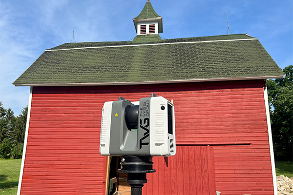
Using the Leica RTC360 laser scanner, The Wassi Group captured precise 3D data of the barn’s full structure—documenting the timber framing, joints, and surrounding features in high detail.
The captured point cloud data was then processed and registered in Cyclone REGISTER 360, ensuring accurate alignment across all scan stations before final delivery to the client.


Our scope of work included:
- High-definition 3D laser scanning using the Leica RTC360
- Point cloud registration and alignment in Cyclone REGISTER 360
- Export and delivery of the complete point cloud dataset to Firmitas


Results
The final deliverable provided Firmitas with a high-accuracy point cloud, serving as a reliable foundation for their restoration and modeling efforts.
This dataset enabled Firmitas to:
- Analyze existing structural conditions with high-level precision
- Plan restoration work with confidence in the dimensional data
- Preserve historical integrity through accurate digital documentation
By combining advanced scanning technology with precise data registration, The Wassi Group delivered an efficient, high-fidelity dataset that supports Firmitas’s ongoing mission to preserve timber-frame architecture with accuracy and care.


Need Accurate Scan Data for Restoration or Preservation?
Contact The Wassi Group to learn how our laser scanning services can support your documentation, modeling, and restoration workflows with unmatched precision and efficiency.