PROJECT SUMMARY
When a facility team needs to plan work around existing structures, accurate existing conditions documentation is the foundation everything else depends on. For Alto Ingredients, that meant getting accurate, verified data on a section of their pipe trestle before any planning could move forward. The Wassi Group was brought in to capture those existing conditions using 3D laser scanning and deliver a coordinated Revit model their team could actually work from.
The Challenge
The pipe trestle running through Alto Ingredients’ facility sits in close proximity to adjacent building exteriors — and that spatial relationship matters when planning any future work. Before design or coordination efforts could begin, the team needed to know exactly how the structural elements of the trestle related to the surrounding structures.
Relying on existing drawings wasn’t a viable option. Facilities evolve over time, and documentation doesn’t always keep pace. Without a verified picture of what was actually in place, any planning effort carried real risk of costly field conflicts down the road.

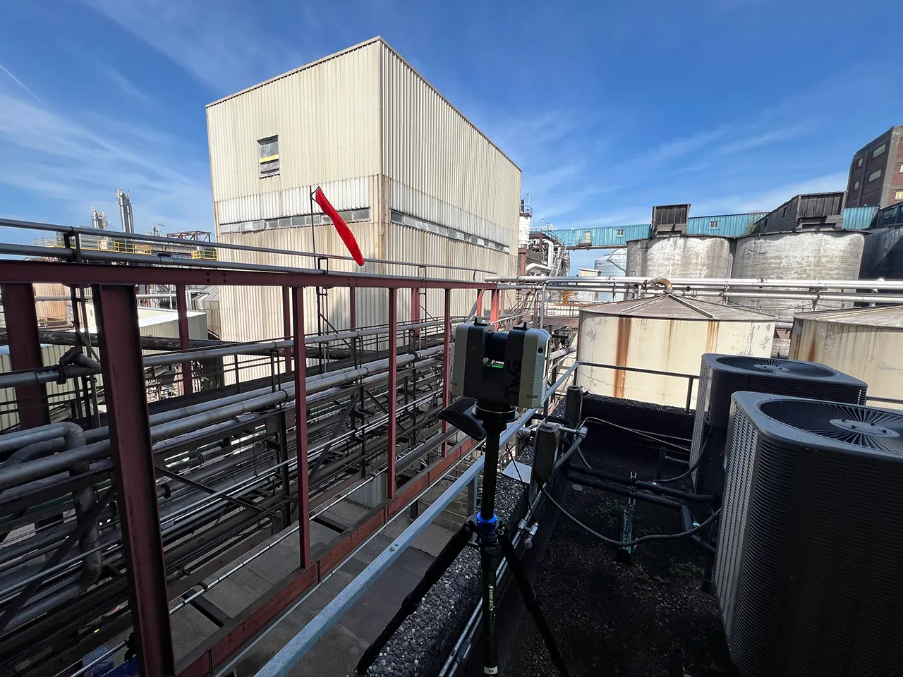
TWG’s Approach
Our team conducted an on-site laser scan session using the Leica RTC360, capturing the full geometry of the trestle section and its relationship to the neighboring building exteriors. The RTC360 produces high-accuracy point cloud data quickly — minimizing time on-site while capturing the level of detail needed for reliable existing conditions documentation.
From there, we processed and registered the scan data in Cyclone360, producing a clean, survey-grade point cloud. That point cloud became the foundation for a coordinated Revit model, accurately reflecting the structural elements of the trestle in their true existing positions relative to the adjacent facades.
What TWG Delivered
- Coordinated Revit model of the pipe trestle structural elements
- Building exterior context modeled in relation to the trestle
- Construction-ready sheets generated from the Revit model


The Outcome
Alto Ingredients walked away with a verified existing conditions Revit model they can trust. Instead of relying on outdated drawings or field estimates, their team now has accurate documentation that reflects what’s actually in place — giving them a reliable foundation to plan the next phase of work from with confidence. The risk of costly coordination surprises is significantly reduced before a single decision is made.

Why It Matters
Industrial facilities are complex environments. Pipes, structural steel, and building envelopes often interact in ways that aren’t captured in original drawings — especially in facilities that have evolved over decades. When renovation or maintenance work is planned without verified existing conditions data, field conflicts are almost inevitable.
3D laser scanning changes that equation. By capturing what’s actually in place before planning begins, facility teams can coordinate more effectively, reduce rework risk, and move into the next phase of a project with far greater confidence. The Wassi Group’s scan-to-BIM workflow — from RTC360 capture through Revit model delivery — gives industrial clients exactly that foundation.
Ready to Document Your Facility?
We work with architects, contractors, and project teams throughout Central Illinois and beyond — and we genuinely love what we do. Whether your project calls for 3D laser scanning, CAD drafting, or photorealistic renderings, our goal is always the same: give your team accurate, reliable documentation you can build from. Interested in what we do? We’d love to talk!